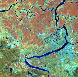
 The processes of satellite imagery are a whole lot more involved and fascinating than they may seem at first.
 It's not just aiming a camera at the earth - a camera several hundred kilometers up - and snapping a picture. To go a step further, it's not just a record of the visual intensity within each "pixel" of the eye of the "camera," mapped onto a pixel of the image we ultimately see.
This site, from scientist Ned Horning at the American Museum of Natural History (hmm...), is a fantastic introduction to this field - I'm working my way through the Basic Concepts sections right now. I HIGHLY recommend it, if you have half an ounce of interest in where those astonishing images you've seen come from.
More great satellite imagery places:
- European Space Agency
- NASA's Earth Observatory
- Space Imaging (commercial)
No comments:
Post a Comment